GKG Geographic Network Visualizer

Dataset: Global Knowledge Graph
Description: Creates a geographic network of the cities and landmarks most closely associated with a search and their co-occurances and produces a set of images and georeferenced network files.
Components: PERL, GraphViz
Acknowledgements: Makes use of GraphViz to create the preview images.
Examples: Geographic Networks: Contextualizing Relationships in Space
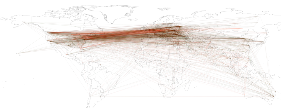
The GKG Geographic Network Visualizer allows you to rapidly construct georeferenced networks from the GDELT Global Knowledge Graph (GKG) to understand spatial connectivity in your search, and creates a set of visualizations and output files. All GKG records are scanned for your search criteria and a list compiled of all of the city, landmark, and administrative division (roughly equivalent to a US state) locations found in each record, along with which city, landmark, and administrative divisions each co-occurs with. The end result is a georeferenced network diagram that captures not only the spatial affinity of a given search, but also uniquely its spatial connectivity, exploring not just what locations are most closely associated with a search, but also how those locations are themselves connected to all other locations. Two preview images are created, one with white edges drawn on a black background to make the overall structure of the network immediately clear, while the other colors each location and edge by its tone, from bright red (high negativity) to bright green (high positivity), offering the ability to see how certain locations are paired in more negative or more positive lights. A Google Earth .KML file allows you to load the network into Google Earth, including all of the connections among locations. A special Gephi .GEXF file is generated that encodes the latitude and longitude information of the network and the coloring of each edge, suitable for layout through Gephi's Geo layout algorithm. Finally, two GraphViz .DOT files are created that can be loaded into a number of different network analysis packages or rendered using GraphViz to produce the two preview images.
No programming or technical skills are required to use this heatmap visualization - you simply specify a set of person or organization names, locations, or Global Knowledge Graph Themes, along with an optional date range, and the system will automatically search the entire Global Knowledge Graph for all matching entries and compile the final georeferenced network diagram. Your results will be emailed to you when complete, usually within 10 minutes, depending on server load and the time it takes to perform the necessary calculations. All GDELT Global Knowledge Graph records are scanned for your search parameters and a geographic network compiled of the locations found across all matching records. Thus, selecting "Vladimir Putin" as your search criteria will generate a network diagram of all of the locations across the world most closely associated with him and their respective co-occurances.